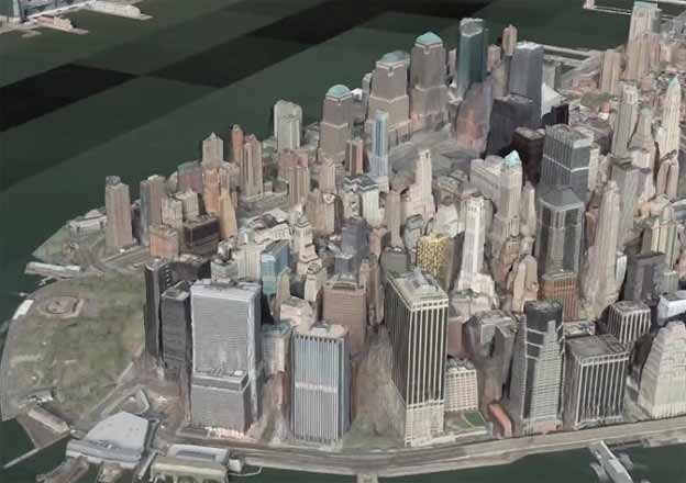
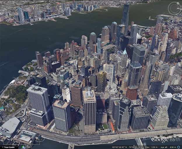
Saab and DigitalGlobe have announced a new joint venture called Vricon. It will be a Google Earth like product featuring 3D models similar to the 3D mesh that Google is rolling out. The key difference is that Vricon is using DigitalGlobe’s satellite imagery to create the 3D, whereas Google uses aerial imagery that must be specially captured for the areas they wish to map. This means that although Vricon’s imagery will necessarily be of lower resolution, it can have far greater reach and can be produced from the already existing DigitalGlobe archives. Also of note is that this is a commercial product targeted at enterprises and governments, whereas Google Earth is a free product.
To see sample 3D imagery see the various demonstration videos at Vricon’s home page. For a tour of various locations look under “Capabilities->Explore Vricon 3D data”.


As you can see above, the Vricon 3D model struggles with the gaps between buildings. Google’s 3D models often have similar problems but it is more pronounced in the Vricon model due to the lower resolution. Also of note in the New York images above, the Vricon model seems to have completely failed with the new World Trade Centre towers. This is likely due to the fact that they use satellite imagery from a range of dates, including during the World Trade Centre construction, which would have confused the algorithms used to create the 3D.
One of the locations featured in the promotional videos, is Beijing, China. Google has not yet released any 3D for China – possibly due to the difficulties in getting clearance from the Chinese government. However, with satellite imagery no such clearance is necessary. So maybe Google should consider using a similar technique to provide lower resolution 3D in areas where they cannot gather aerial imagery. The only problem is that Google does not have access to the full archive of DigitalGlobe satellite imagery, and now that DigitalGlobe has the commercial Vricon product, they might be reluctant to allow Google to use their imagery to create a free version. There are, however, other satellite imagery providers that might be willing to work with Google. DigitalGlobe, however, has the highest resolution satellite imagery available coming from their WorldView-3 satellite.


